The flagship
Ground Truth, under one centimeter.
An up-to-date record of every exterior surface across your portfolio: measured from the air, scored, and compared from one flight to the next.
The viewer
Look at the ground.
One of our own captures: a retail site at under a centimeter per pixel. Zoom from the whole parcel down to a single crack, and switch the surface colors on or off.
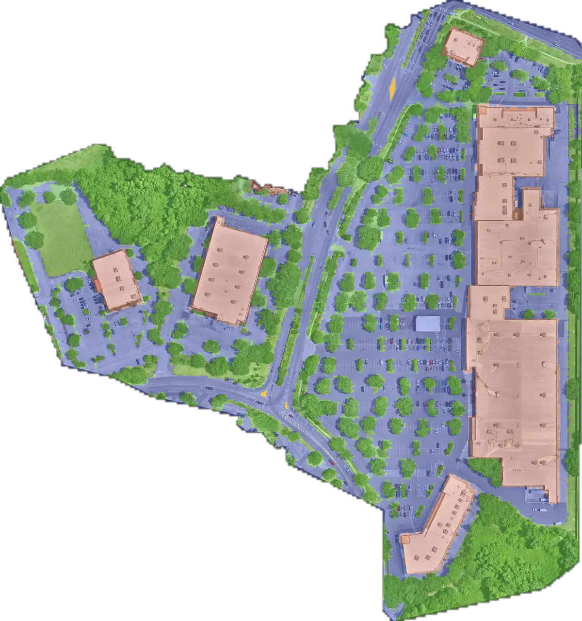
Drag to pan · + and − to zoom · click first to zoom with the mouse wheel · Esc to release.
From a baseline to diligence.
Baseline
Map every surface and its area.
For acquisitions, insurance and vendor bids.
Condition
Score pavement, roofs and landscaping.
For capital plans and preventive maintenance.
Change
Compare one flight with the next.
To verify work, catch wear early and support claims.
Diligence
Package a standard record of the property.
For sales, leasing and portfolio reporting.
Each surface gets a 0–100 condition score, the scale pavement engineers already use. You receive GeoJSON, CSV and PDF, along with the imagery.
- Whole property
- 74.2Good
- Pavement
- 57.0Fair
- Roofing
- 94.6Excellent
- Landscaping
- 83.1Good
Condition index, 0 to 100.
Read the sample report(4-page excerpt, PDF)Inside the platform
What you work with.
Portfolio map
Every property in one view, with surfaces, condition and change as layers.
Condition detail
From a portfolio score down to one patch of pavement, with the imagery behind it.
Work orders
Each finding becomes a located job with the evidence attached.
Capital plans
Rank what to fix first and compare plans before you commit budget.
What you get
- Measurements (GeoJSON)
- Annotated imagery
- Condition scores
- Repair priorities
- Evidence for work orders